
Recent Posts
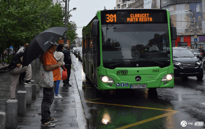
The buses on lines 381, N113, N117, and N119 will also stop at the new “George Enescu” station
Starting Wednesday, November 12, 2025, the buses on lines 381, N113, N117, and N119 will also stop at the new “George Enescu” station, located on General Gheorghe Magheru Boulevard, in the direction toward University Square. [...]
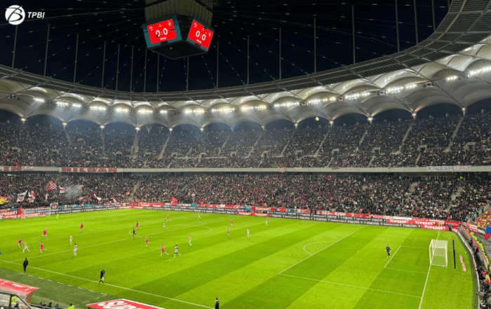
The Dinamo – Csikszereda match: at the request of the Traffic Brigade, bus lines 86, 90, 104, and 143 may be diverted on Saturday
To allow the public to safely attend the football match between Dinamo and Csikszereda, scheduled for Saturday, November 8, 2025, at 5:30 p.m., and only if the situation requires it, at the request of the [...]
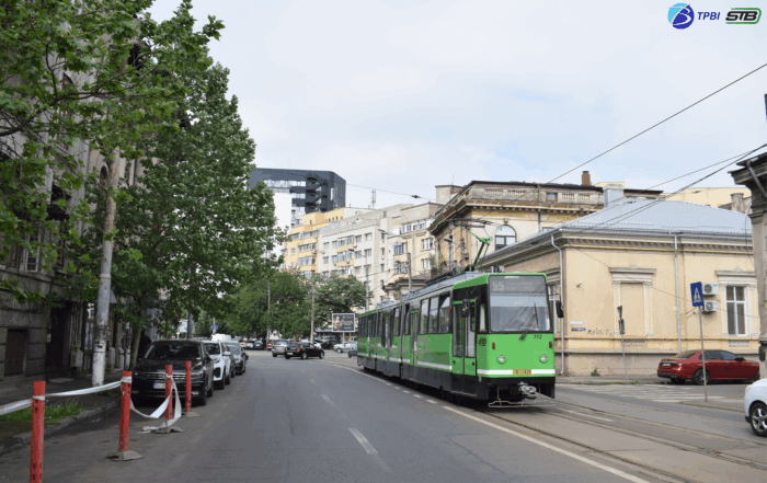
TPBI: Line 14 – suspended on Saturday, and Line 55 – shortened to Piața Iancului. Shuttle Line 614 is being introduced
The trams on Line 14 will not operate on Saturday, November 8, 2025, and Line 55 will be shortened to Piața Iancului due to sewage network maintenance works on Traian Street and Calea Călărașilor. To [...]


Express Line
TPBI constantly improves mobility in the Bucharest-Ilfov Region through various initiatives, and an important example is the Metropolitan Train, which has connected Gara de Nord to “Henri Coandă” Airport since December 2020. The route is operated by two companies, running non-stop at 40-minute intervals, with a journey time of approximately 20 minutes.
Compared to initial estimates, this project has proven to be a real success, with the number of passengers exceeding expectations tenfold in a relatively short period.
TPBI, together with its partners, has implemented fare integration between surface transportation, the metro, and the Metropolitan Train, offering modern payment options such as SMS, bank cards, smartphones, the 24PAY app, or subscriptions valid across all modes of transport, thus providing travelers with multiple mobility options.
Additionally, travelers can use Line 100, a high-capacity rapid bus service, with a frequency of 15-30 minutes, operating non-stop between Piața Unirii and Henri Coandă Airport in Bucharest. This service has a limited number of stops, ensuring a quick connection to key points in the city.


Angular Map App
Route Planning: Provides optimal and detailed routes for public transport, guiding users clearly and intuitively from the starting point to their destination, ensuring an efficient and hassle-free experience.
Real-Time Public Transport: Displays real-time locations, details, and vehicle information.
Advanced Features and Dynamic Data: Real-time GTFS integration for route selection, updated traffic visualization, and a modernized interface for optimal use on any device.